

Fri, 4 Dec, 9:00 am
AOT Lagos 2025
Landmark Event Centre, Lagos
Free
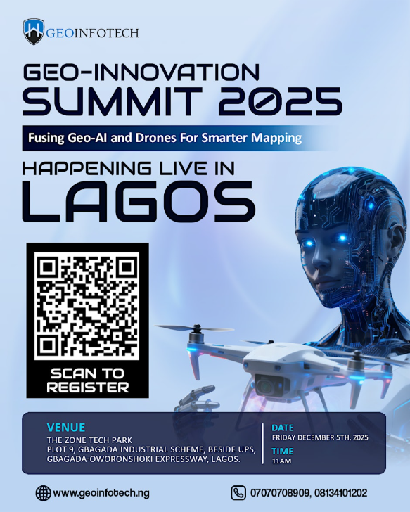
A focused summit in Gbagada exploring advancements in Geo-AI, drone technology, and next-generation mapping solutions for Africa's urban and agricultural future.
Free
The Geo-AI & Drone Technology Summit brings together GIS professionals, drone engineers, urban planners, agricultural technologists, and government mapping agencies for a full day of demonstrations, keynotes, and hands-on workshops at The Zone Tech Park in Gbagada.
Core tracks:
1. Geo-AI Applications
- Machine learning for satellite imagery classification
- Real-time flood prediction using geospatial models
- AI-assisted land use mapping for urban planning
2. Drone Technology
- Beyond visual line of sight (BVLOS) operations in Nigeria
- Drone delivery logistics: last-mile healthcare and agriculture
- Regulatory landscape: NCAA drone certification pathways
3. Mapping & Data
- OpenStreetMap and community-driven mapping in underserved areas
- LiDAR integration for infrastructure assessment
- Building digital twins for African cities
Includes live outdoor drone demonstrations, a startup showcase, and a hackathon challenge with ₦2M in prizes. Free entry with RSVP.
The Zone Tech Park
Plot 9, Gbagada Industrial Scheme, Gbagada, Lagos, Nigeria, Lagos, Lagos, Nigeria
Free on-site parking inside the tech park, with a marshalled drone-operations exclusion zone on the rear apron.
Level access across the ground floor and lift access to the workshop rooms; the outdoor flight demo has a seated viewing bay.